
Ordnance Survey’s Great Britain in Minecraft
- Updated: 24th Sep, 2013
Ordnance Survey, the national mapping authority known by GCSE Geography students across the the world, has created a map of Great Britain in Minecraft.
Graham Dunlop, Innovation Lab Manager at Ordnance Survey, explained “When Joseph Braybrook joined the team as part of Ordnance Survey’s summer internship programme, we discovered he was an avid Minecraft fan and we decided to explore the potential educational benefits of the popular video game. We decided to build a Minecraft world using free-to-use OS OpenData products to display the landscape and terrain of Great Britain.”
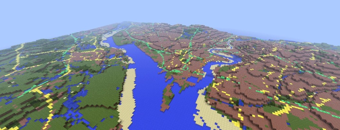
It’s not quite to scale but the team have made every effort to keep the map representative. A roads are depicted in Emerald, B roads in pumpkin, with forests made of leaves (as one might expect) and built up areas made of bricks.
The team used coding to take the raw heights in Ordnance Survey’s data and scaled it down to fit within the 256 block height limit in Minecraft. A maximum height of 2,500 metres was chosen, which means Ben Nevis appears just over 128 blocks high. Although this exaggerates the real-world height, it preserves low-lying coastal features such as Bournemouth’s cliffs, adding interest to the landscape.
– Ordnance Survey press release
When playing the map, you’ll start next to the Ordnance Survey offices in Southampton. You won’t find landmarks like Stonehenge or Uffington White Horse but that’s okay. It just saves you the guilt of destroying them. Alternatively, you could always build them yourself.
The Great Britain Minecraft map requires 5GB of space and you can download from the Ordnance Survey website – Minecrafting with OS OpenData.
Follow Us!